Sussex Coast Walk - Stage Two - A Collective Sigh Of Beauty And Relief
There really is nothing like getting a project underway.
Whilst those first few steps can be months in the planning and feel so difficult to take, once you are up and running then everything feels lighter somehow and seems to move so much faster.
So stage two of our Sussex coastal adventure has followed on rather quickly from our first effort last week.
This time around we decided to park at our destination, in Hastings, and take a bus across to the start. So we parked in the delightfully named Bohemia and took a 50 minute ride along steep and rather winding roads, wondering whether this was an accurate clue as to what this walk might be like.
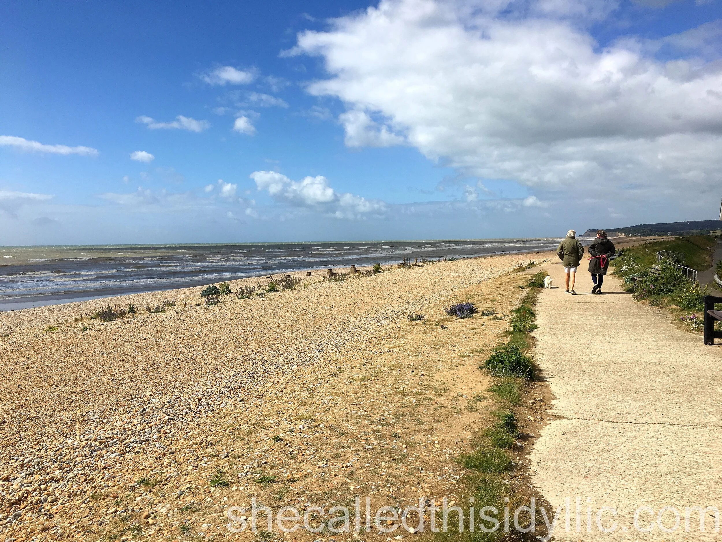
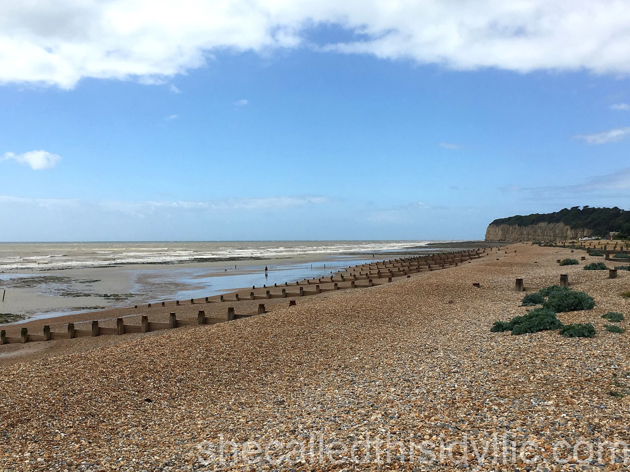
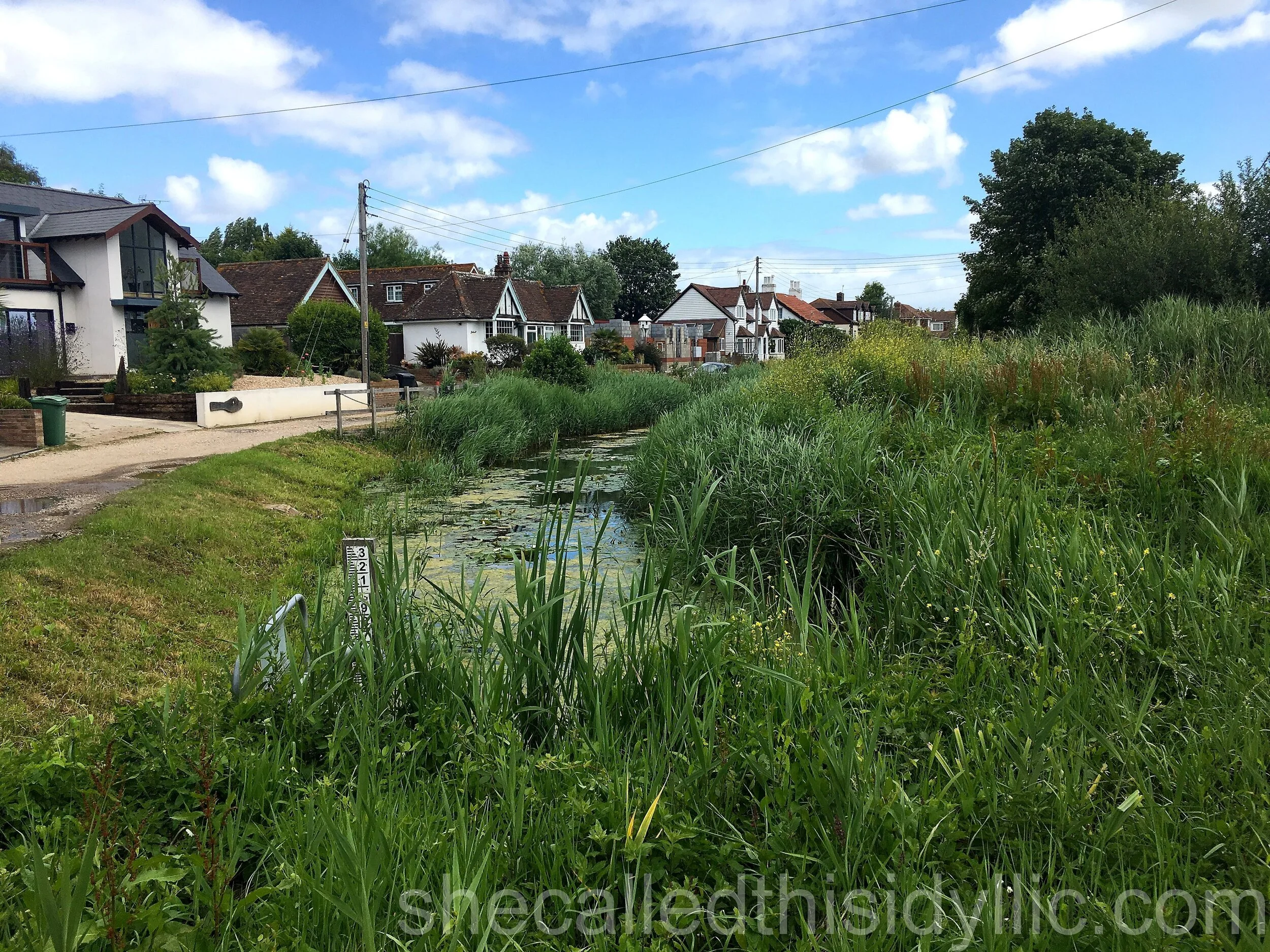
Having been welcomed to Hastings by heavy rain we were much happier to begin in pleasant, if not overly warm, sunshine at Winchelsea Beach. The place was nicely deserted and the first part of our walk was mostly along the grass track that topped the flood defences alongside Pett Level beach. With impressive views to our right over the former marshland and the attractively named Dimsdale Sewer, we set a steady pace in the morning sunshine.
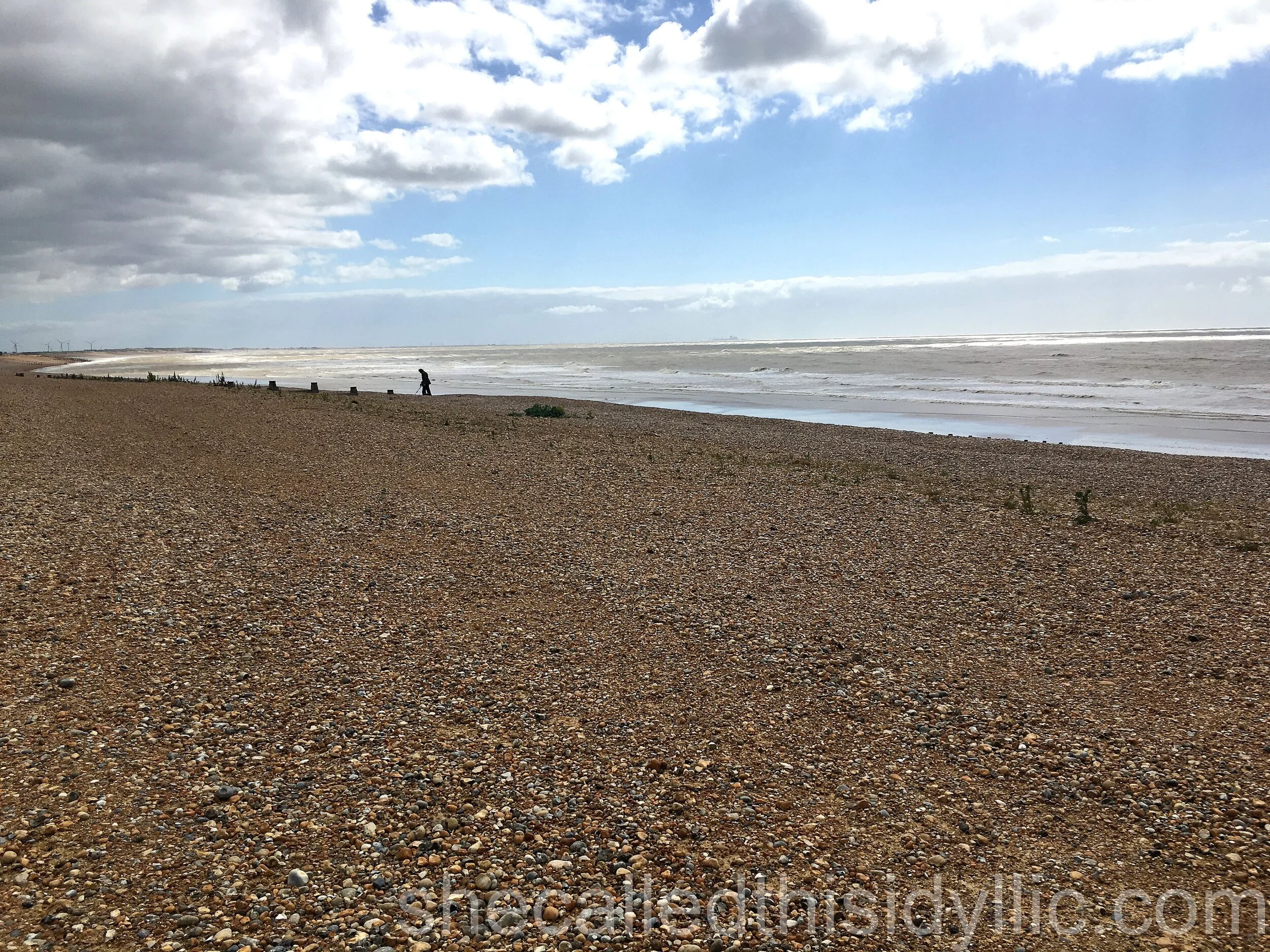
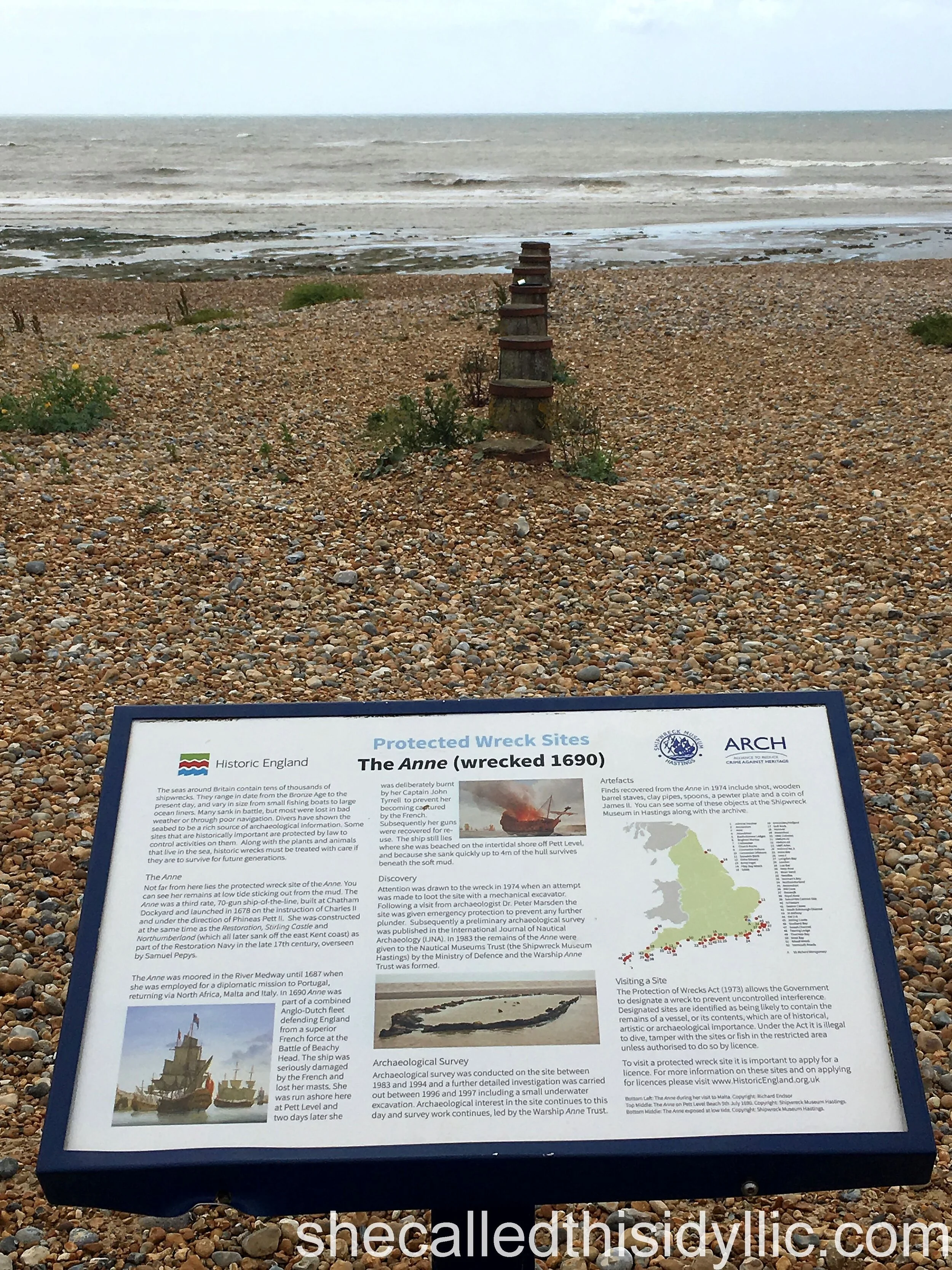
Not too far in we passed a sign on the beach indicating that an old shipwreck of The Anne was visible still at low tide. Sadly, and despite walking down to the sea to check, it was not visible to us. Originally a 70 gun war ship, it was run aground at Pett Level beach by the French in 1690 after the Battle of Beachy Head. Who even knew that Beachy Head had a battle named after it. Our rather patchy knowledge of random local history seems to be improving with every walk.
As with stage one, some post-walk research unearthed another fascinating fact about where we had just been. For those of us old enough to remember classic music videos from the early 1980’s, it turns out that one of the first and perhaps most iconic, Ashes To Ashes by David Bowie, was partly filmed at Pett Level beach. Sadly, we saw no Pierot outfits or information boards to this effect as we made our way over the shingle.
We reached the village of Pett Level and found the rather attractive Royal Military Canal alongside the road. Originating near Folkestone, this 28 mile long canal was intended as a defence to possible invasion during the Napoleonic Wars. Finished in 1809, it never saw military action even though it was further fortified and manned during World War 2.
Almost opposite the canal we located the rather well disguised footpath that started us on our gradual and first climb of the day, up to the top of the cliffs.
Note my very careful use of the word “first”.
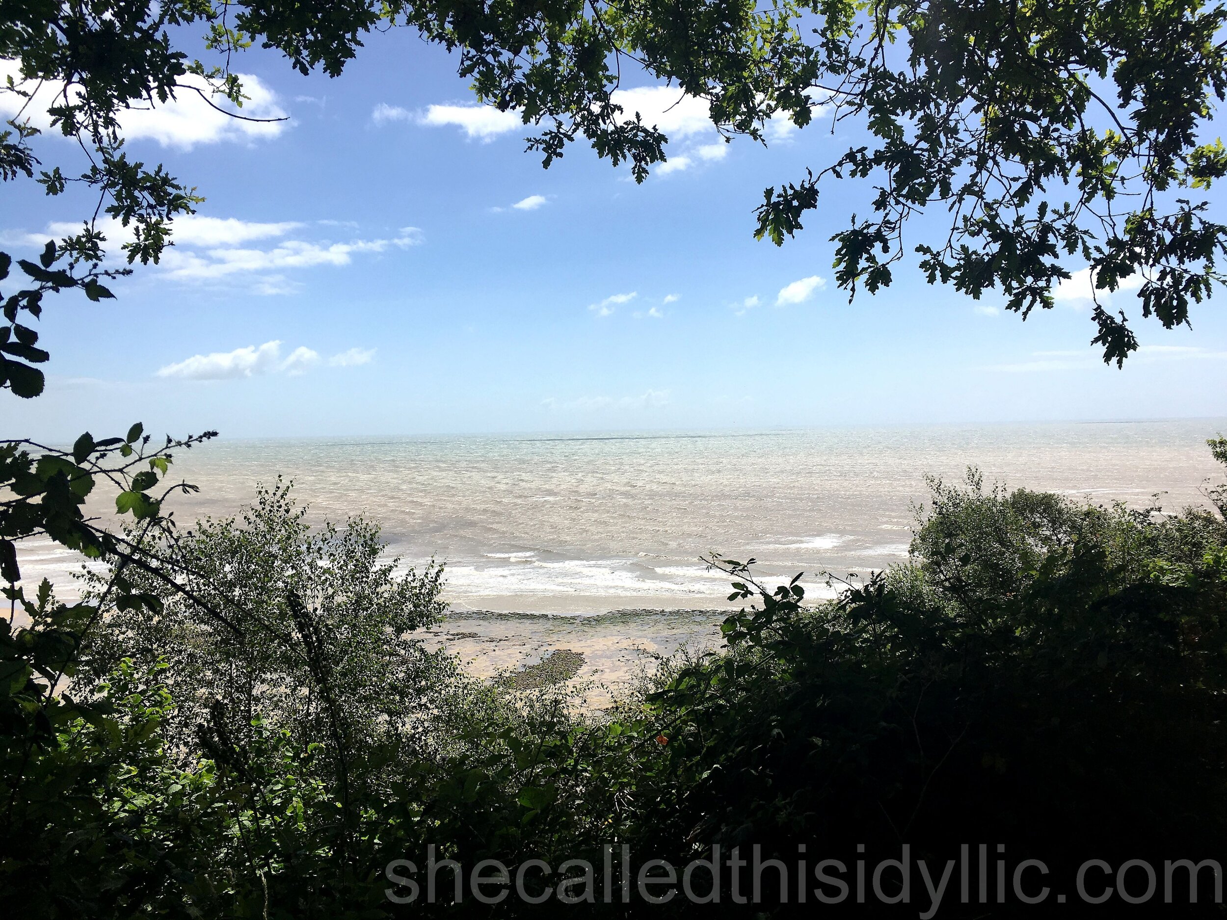
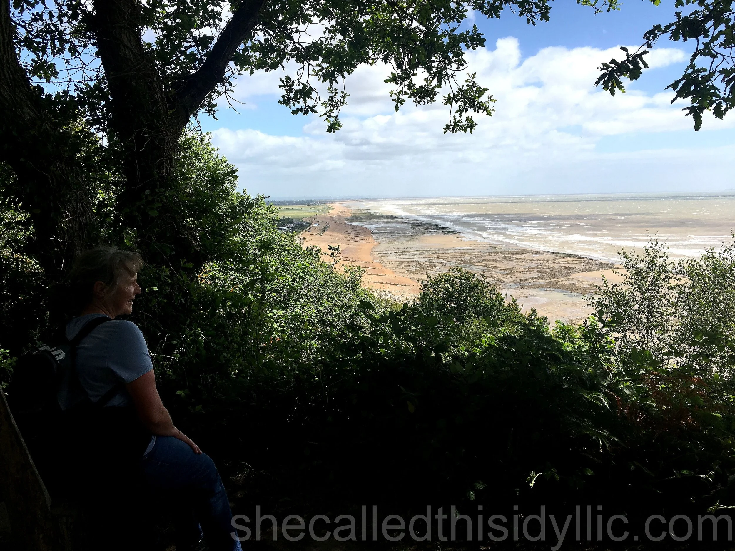
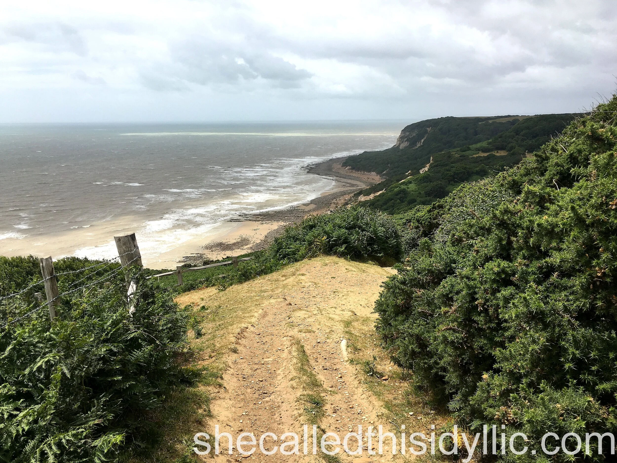
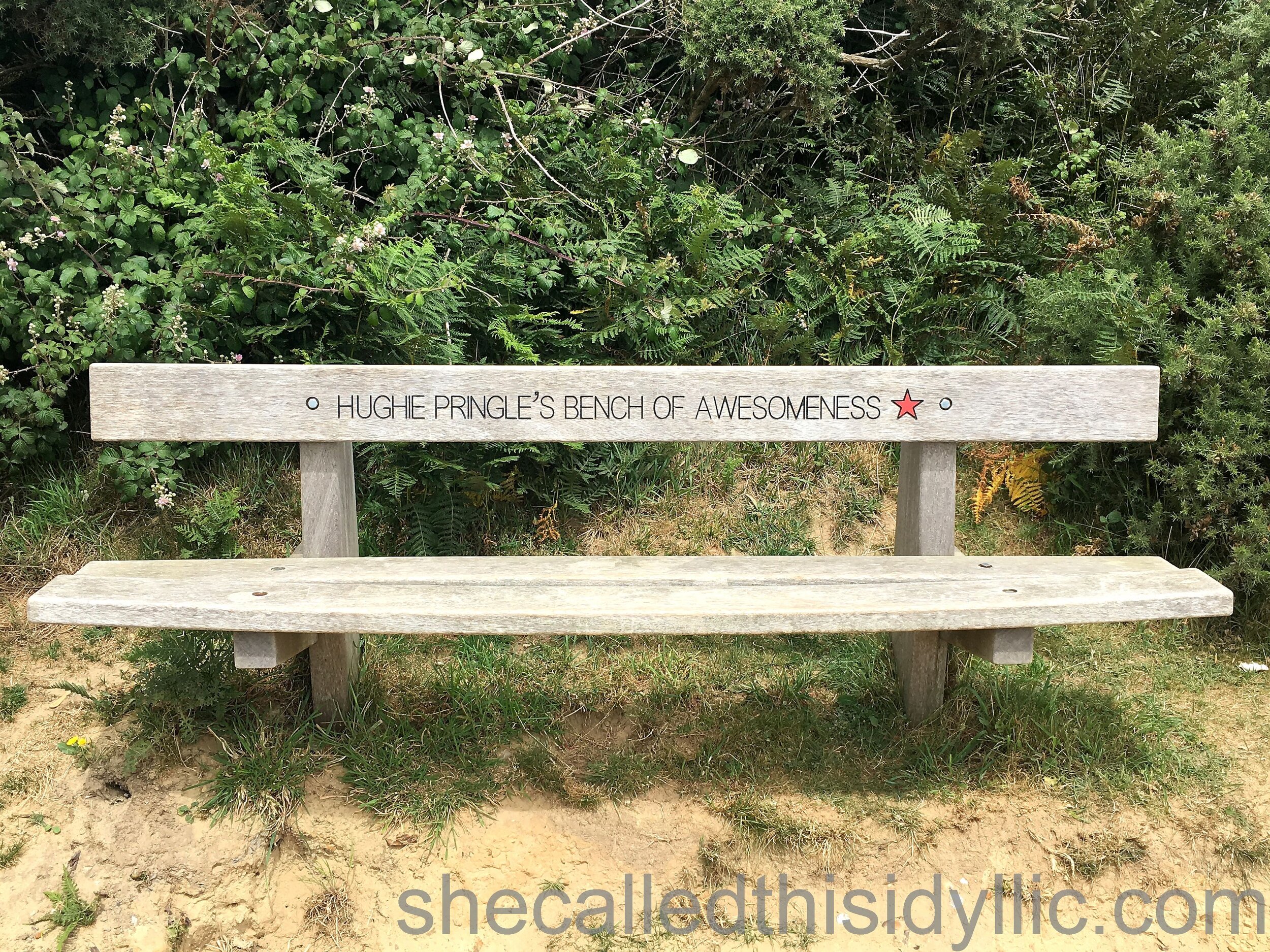
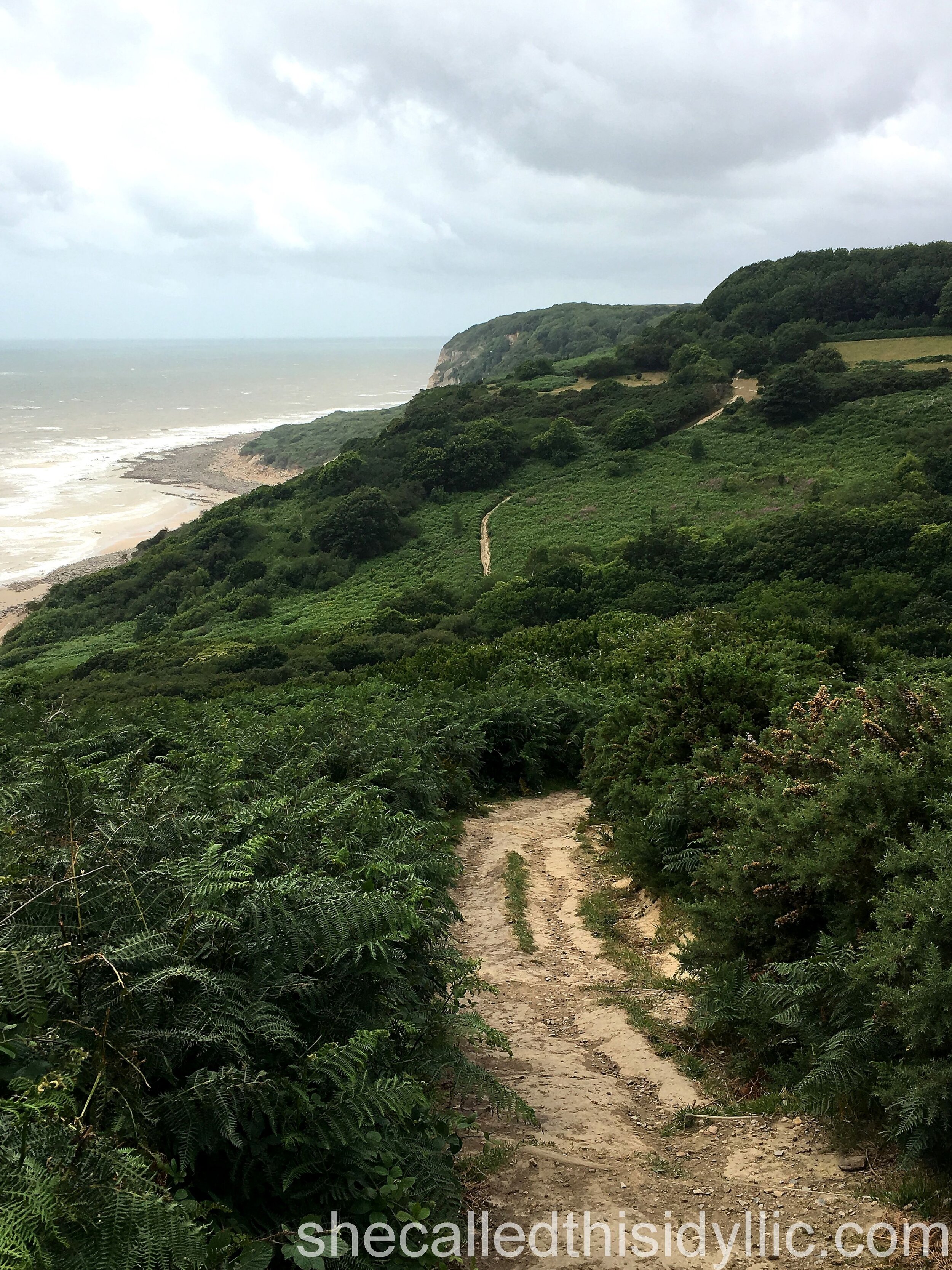
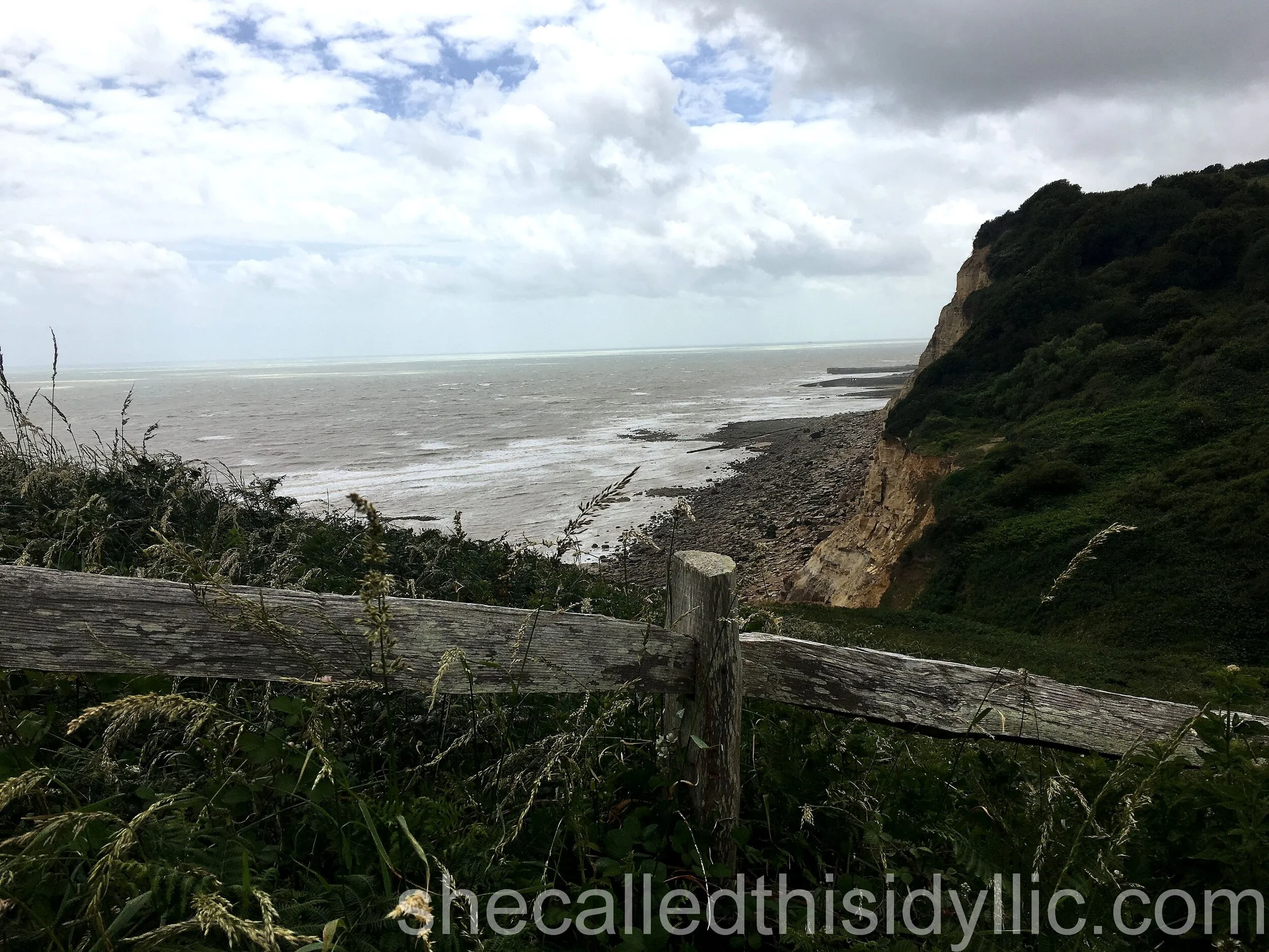
This part of the walk was absolutely stunning in places with wonderful views out over Rye Bay. One place in particular, unidentified but part way along the cliff top path, is already top of the list of most beautiful places we have visited on our walk to date. Hidden away on a grass path at the end of the gardens to some very impressive houses, we found the most perfectly framed view through the trees and back down the beach that we had just walked, There was even a very special bench perfectly placed to add to the enjoyment. The path then continued into the cliff top village of Fairlight before entering the eastern side of the Hastings Country park and, more specifically, the area known as Fire Hills. This part of the park is apparently named after the glorious flowering gorse bushes, covering the hillside although sadly not sharing their colours at this time of the year.
We stopped briefly on Channel Way, a very exposed road with open views out to the sea, right at the very edge of Fairlight. Apart from photographing the views, our pause was also due to something we noticed in one of the front gardens. With a small sign to help passers by like us, it explained that the rather large propeller sat in the centre of the lawn was in fact from a German Messerschmitt BF 110 fighter and had been trawled from the local sea bed as recently as 2006. During the war, the Fairlight Radar Station had been located just a short distance down the road and this resulted in the local area becoming a target for the German Air Force.
Once into the country park, we found a place up on the highest point, just by the old radar station in fact, and took a break for lunch. At this point, we were slightly surprised to find our phones both displaying the same message from our service provider and welcoming us to France.
Close but not quite.
Perhaps a little smugly, we calculated over lunch that we were well over half way through our walk and had yet to find any of the going tough. In fact, apart from a few climbs, it had been pretty easy.
We should have known better.
We saw a sign shortly after lunch that advised us that it was three and a quarter miles to Hastings. A rough calculation of an hour, maybe an hour and a half, to get to our destination was made as we continued walking. How wrong could we be.
It was just after this point that we were reminded that cliff top paths are rarely level and never, ever, without their challenges.
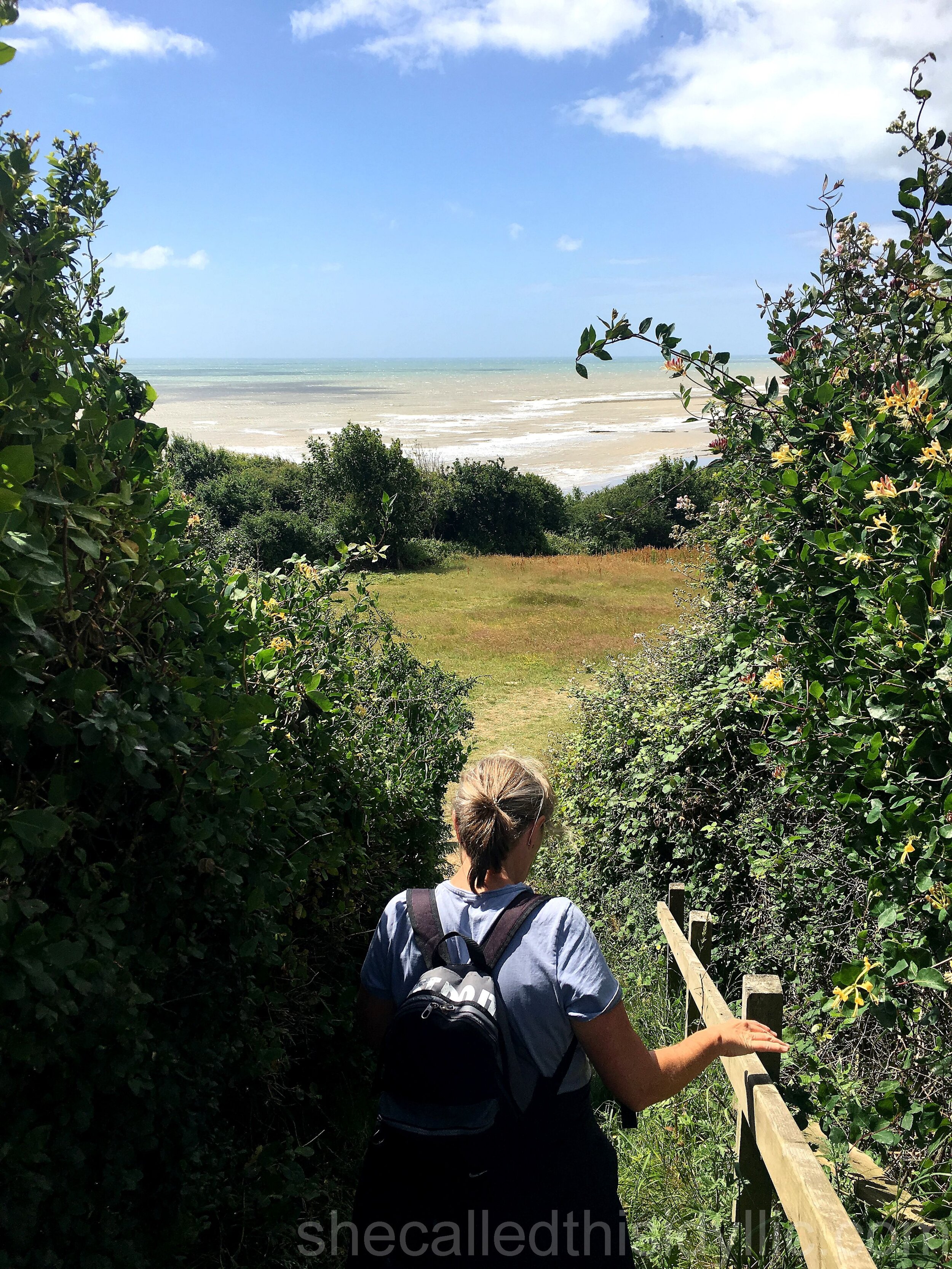
What followed was an incredible walk. Through woodland, across open and exposed cliff tops, past hidden and secluded beaches, down steep paths and even steeper steps and, of course, back up the other side again every time we descended. In total, four long and steep climbs appeared over the next few miles in what has to be the wildest and most spectacular of country parks that I have ever experienced.
And of course, when we found out that some parts of our cliff top path, following the old Saxon Shore Way, had been closed due to erosion, well, it was inevitable that we would get lost whilst trying to follow the detours.
In fact, we managed to get ourselves lost four times during the walk, even with an Ordnance Survey map in hand, asking for help and finding it from some very kind locals. One helpful dog walker even came back again for a second attempt at directing us in case he had confused us the first time.
Which he had.
So when we finally began the decline into Hastings, the collective sigh from the pair of us was not just from the sight of the old town in the mid-afternoon sunshine, but also out of relief that we had successfully found our way out of the country park.
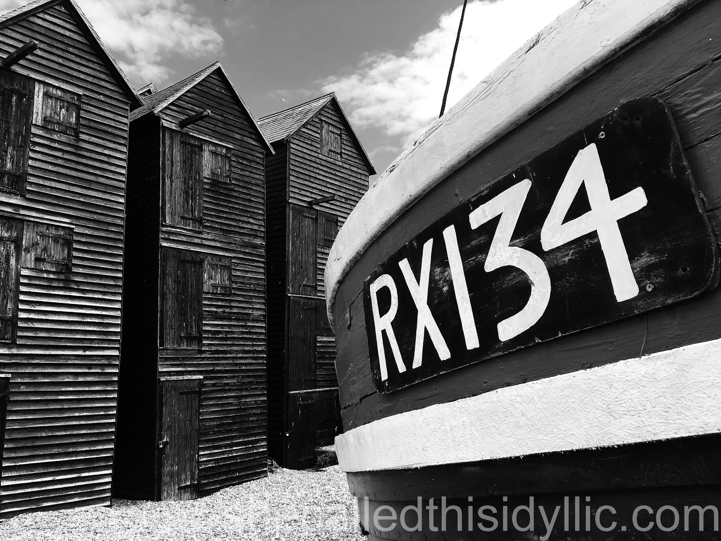
A short stop by the famous old fisherman's huts on the beach after we reached ground level again was welcomed, and then the last stretch along a very sunny and incredibly windy sea front. It felt good to end our walk as we had begun it, with the sun shining brightly onto a shimmering sea and us walking, thankfully, on flat ground.
I felt every single step as we gradually and slowly made our way to the pier, with the wind blowing strongly into our faces. But we made it and, to be honest, it left us with a mix of emotions. Immense satisfaction, of course, to have reached our goal. Yet we were also overcome with tired frustration as we realised, rather ruefully, that we still had to walk back up the hill to Bohemia to collect the car.
Stage two. Done it.
Stage 2 – Winchelsea Beach to Hastings Pier
Date of walk - 29th June 2020
Distance walked 9.37 miles / 15.08 km
Floors climbed (using Apple Health app.) 128 floors
Ongoing totals 18.18 miles / 29.26 km / 139 floors