Wherryman's Way Walk - Stage One - The Never Ending Road
So, it's been a while since we last challenged ourselves to a long distance walk.
A long distance walk in stages, of course.
In fact it was 2020, during the “in and out of lock down” era, that we last completed such a challenge.
And whilst we have been walking since then, it has not quite been the long distances and organised challenges of before, for various health reasons mostly.
So we decided to embrace The Wherryman's Way walk as something to keep us occupied during a rather luxuriously long stay in the Norfolk countryside. A place we already love.
It's supposed to be 38.2 miles (61.12 km) in length and traces, more or less, the River Yare from the centre of Norwich to the North Sea at Great Yarmouth. We shall see how accurate this is.
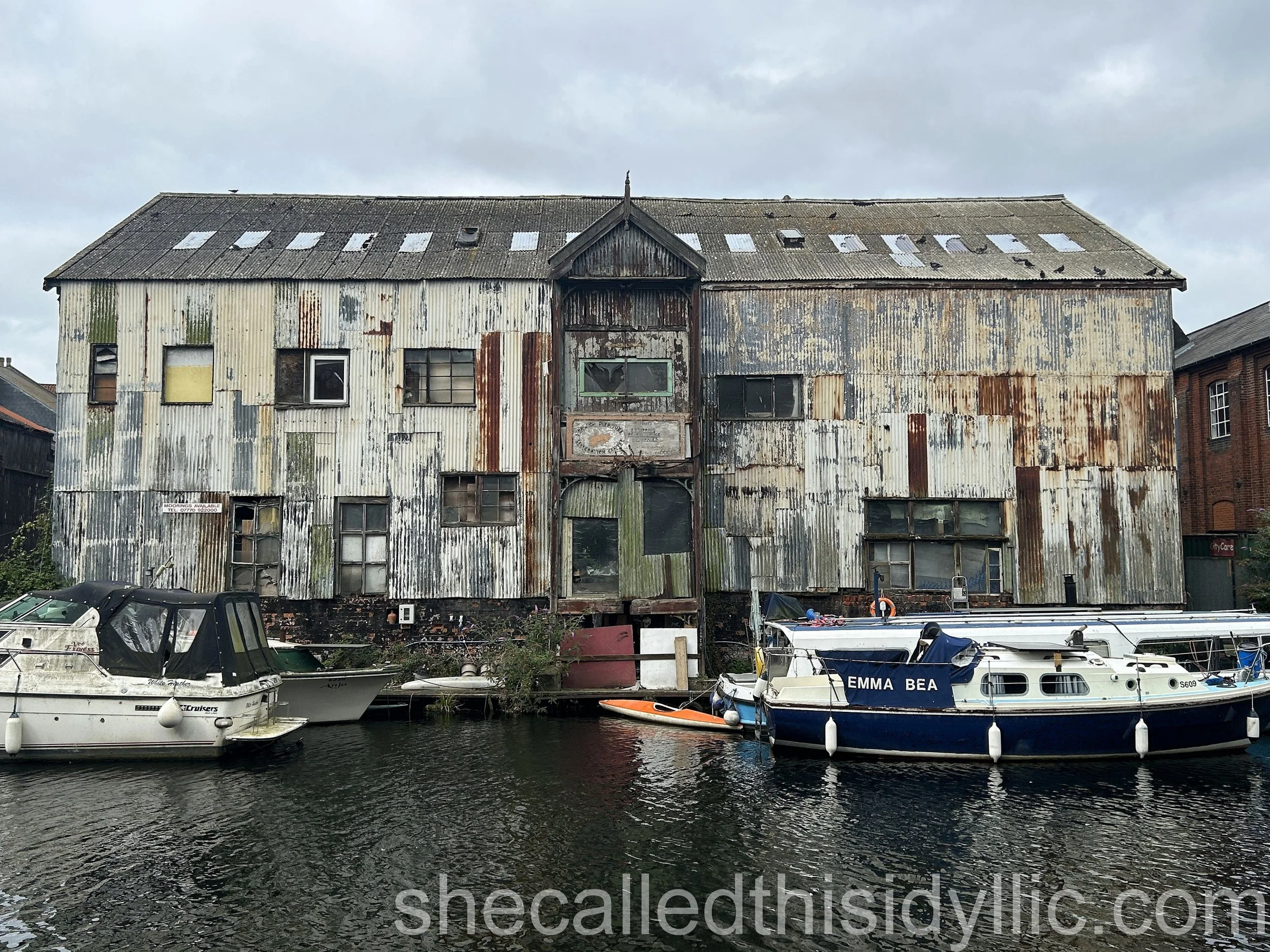
We started at Norwich station on a grey August morning, finding the river just a few steps from the main entrance. Perhaps not the best of signs, but the guidebook we are using managed to confuse us before we even saw the water. However our well practiced looks of confusion managed to attract the attention of a very friendly woman who walked the first 10 minutes or so with us. She shared stories of husband number one, who promoted gigs in a wonderful old warehouse that we passed (and I photographed) and husband number two, who fitted the windows into some very swish apartments. In fact she was really helpful and enthused about our challenge. We believed her when she said she would rather walk with us to Great Yarmouth than continue on her journey to work!
We pottered around the outskirts of Norwich for a while, finding some rather interesting derelict buildings that I really wanted to explore, before heading out into the country. We walked through the Whitlingham Country Park, part of an estate owned by the famous Colman's Mustard family, and passed the ruins of Trowse Newton Hall. The ruins were largely covered by ivy, part of which was being removed as we visited, but their history included a stay by King Edward III and damage during the food riots of 1766, which was interesting.
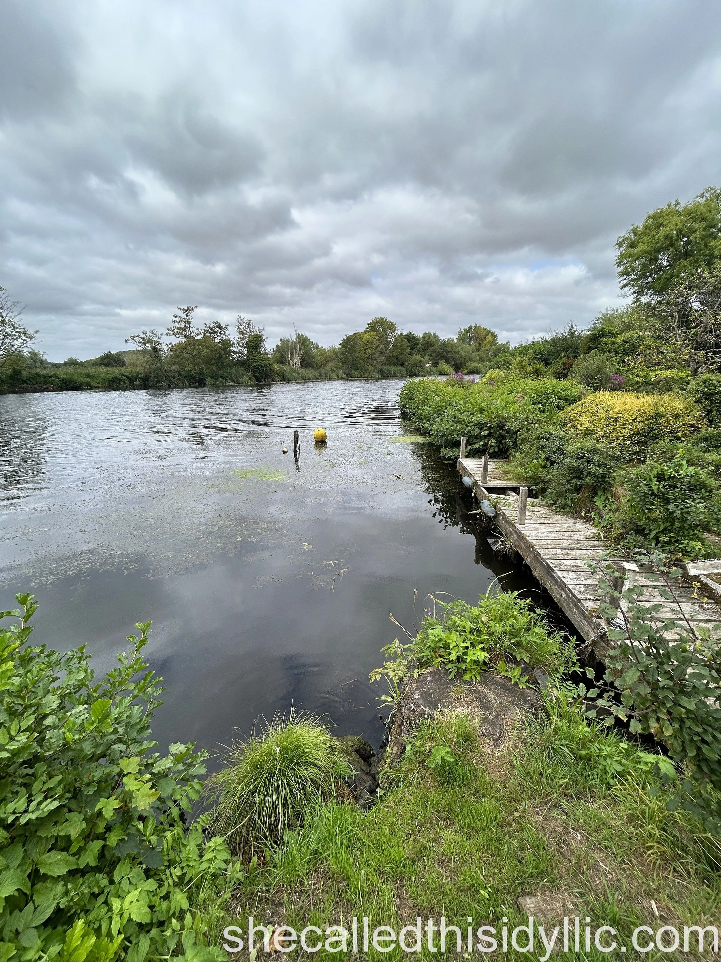
We continued along country lanes, with water on one side and, briefly, the local sewage works on the other, managing to get lost on a couple of occasions thanks to the rather vague instructions we were trying to follow. The least said about us clambering over a locked gate, because we were sure that was the way the path went, the better.
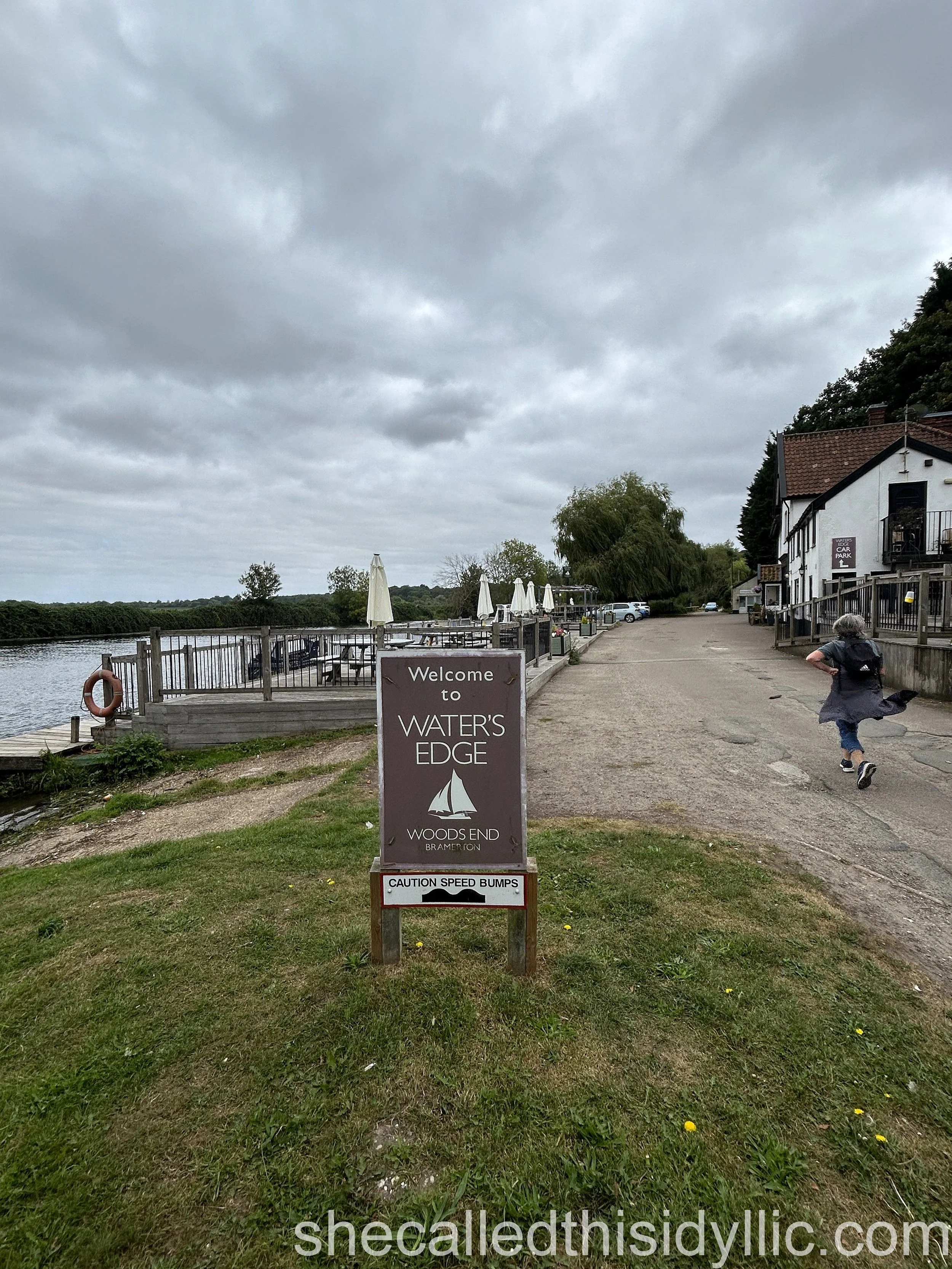
The Water's Edge bar and restaurant at Bramerton was a delight as it appeared at the end of a very narrow lane and we stopped for lunch (sandwiches not the rather pricey restaurant, sadly) on the grassy staithe just along the road.
We followed well hidden tracks, winding between and around some stunning properties and managing to get lost once more.
Anyone that has read some of my previous posts will know my rather strong views about large, privately owned, houses stopping sea and river footpaths from being open and available to the general public. It was not quite as frustrating here as on our Sussex Coast Walk and in fact it was rather charming in some ways even though we were directed away from the river on too many occasions
Rich, entitled land and property owners blocking our natural heritage however remain on my hit list.
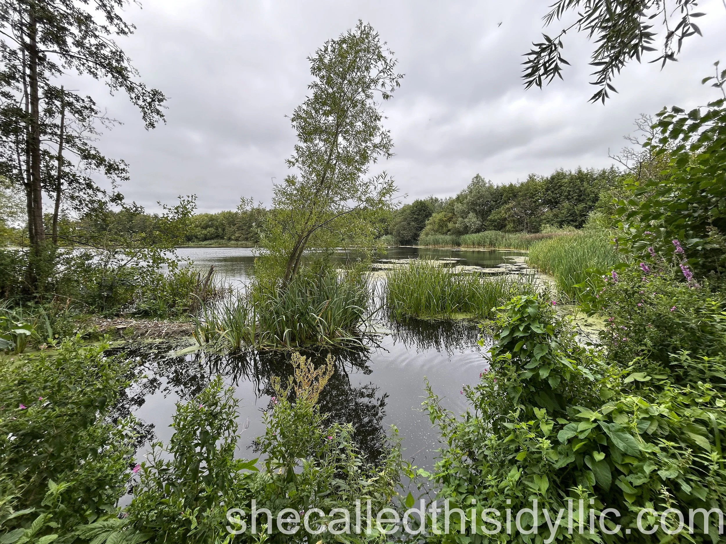
We managed to disturb a sleeping deer and found a lovely isolated bird hide looking out over the reed beds after a brief pause at Surlingham Church, another beautiful example of the Norfolk round tower church style.
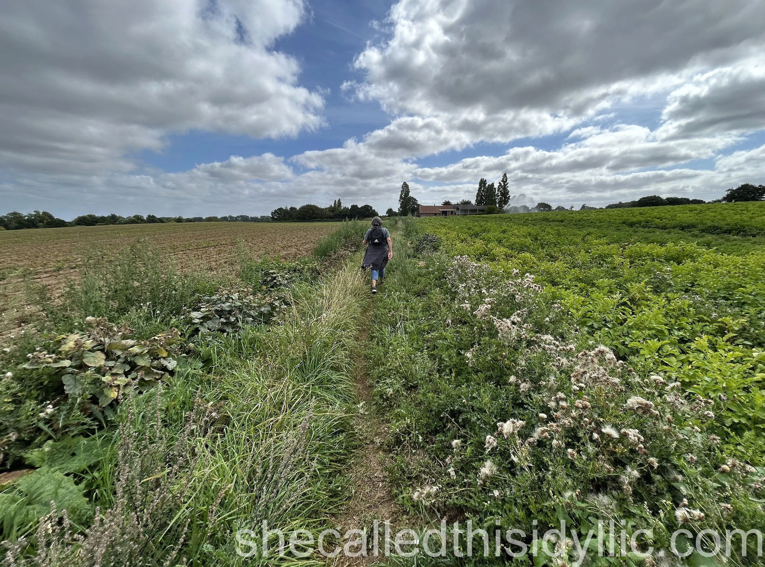
We moved away from the river after walking through the RSPB reserve at Church Marsh and headed up towards where we planned to pick up the bus. Being very aware of the times of the next bus (and the fact that we would have to wait another 90 minutes if we missed it) we took the decision to make a short detour and head up what looked like a simple road into Rockland St. Mary.
Reality was that this road seemed to go on and on and on, turning into little more than a footpath and winding through numerous fields and past a luxurious farm house (and an automatic water spray which we successfully dodged). We walked faster and faster and then, when we finally arrived at the small village and asked a local, were advised that some of the bus stops were not actually marked and we could probably “just stand over there and wave your arms when the bus arrives, he is sure to see you!”
I am pleased to say that the driver did in fact see us, he did stop and he did get us back into Norwich. We took another bus back to the park and ride (three buses in the day, perhaps I should start counting them) and fell into the car ready for the trip home.
Interestingly, even making allowance for the extra mile we had to walk in the morning between bus and train stations and the amount we missed when we made the detour, we both felt that the 10.6 miles that the guidebook suggested for this first stage was rather severely underestimated.
So it was a long stage, almost 14 miles for us in total, but the weather held even if the skies were mostly cloudy.
And it was great to be out on the roads again on a walking challenge.
Stage 1 – Norwich to Rockland St. Mary
Date of walk - 20th August 2025
Distance walked - 13.8 miles / 22.08 km
Floors climbed (using Apple Health app.) - 6 floors
Number of times lost - 3